This page offers a number of maps that might be helpful to you, either as a Saugerties Village and/or Town resident, or as a visitor to the Village and Town.
The sections below cover what the maps are and how you can benefit from them.
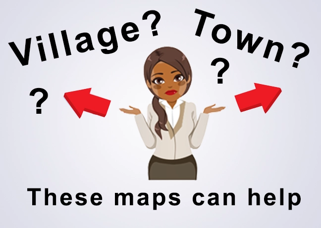 Village of Saugerties? Town of Saugerties? Which one am I in?
The Village of Saugerties (Pop: 3,899, from the 2020 Decennial Census) is wholly contained within the Town of Saugerties. For the Village of Saugerties "About" page, please click here.
The population of the Town of Saugerties (most recently measured in the (2020 Decennial Census) 19,038
Most of the Saugerties citizens who have been living here for years understand the relationship between the Village and the Town. But for anyone who is new or who might be visiting Saugerties, or for anyone who doesn't understand these distinctions fully, here is a very brief tutorial and some maps, as an aid to you.
Those living in the Village of Saugerties are by definition also within the Town. (They pay both Village and Town taxes, for example.) Those living in the Town of Saugerties but outside of the Village boundaries are not Villagers ... and so they pay Town taxes, but not Village taxes.
And by boundaries, we refer to the boundaries shown in the 2 maps accesssible via the buttons below. You can use these maps to check whether you are in the Village and Town, or just in the Town (outside the Village). The first (Town with Village shown within) shows the Town streets as you zoom into the PDF. The second (Village) shows the Village Streets as you zoom in.
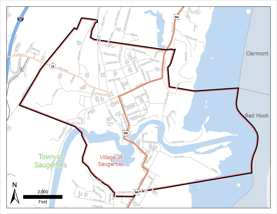
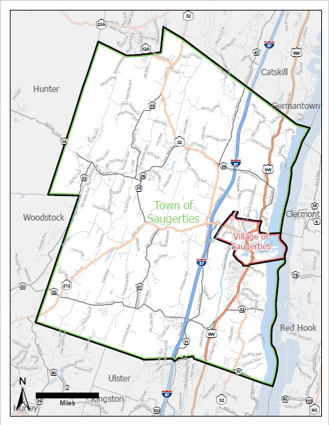
The images above are buttons, which when clicked can get you to PDFs that can be zoomed in on to see street level details within the Town and Village.
Maps are courtesy of Dr. Michael Campbell.
 GIS Maps of the Village and Town of Saugerties
Thanks to the late Myles Putman for providing these 2 useful map documents:
- Village Zoning Map (PDF - 1MB)
- Town of Saugerties Zoning Map (PDF - 14MB)
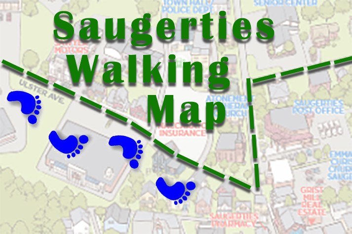 Saugerties Walking Maps
The Saugerties Chamber of Commerce has created a 2025 walking map of the Village of Saugerties, featuring Saugerties' Historic Business District.
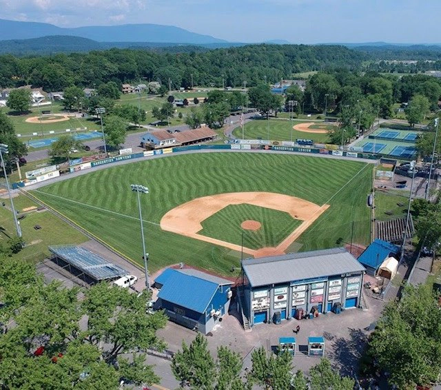 Map of Cantine Field
Sometimes, if you're told where to see an event at Cantine Field, you might be told to go to the "Large Pavilion" or "Field 11", or to "meet at the M2 Entrance" and you might not know where those are. Click here for a map that can help clarify things.
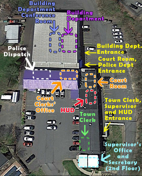 Map of Town Hall
Planning on a visit to Town Hall? This handy map of Town Hall shows the locations of various departments, offices, ... and what the best entrance is to get you right to your destination. Click the link above or the thumbnail image on the right for a larger image of the map.
 Voting District Lookup - Which is My Saugerties Voting District?
To determine your voting district (and the polling place where you need to vote), visit the Ulster County Board of Elections Polling Place Lookup page. (This link seems to come and go, based on proximity to an upcoming election. We'll try our best to keep the link up to date.)
Shown on the right is the winning "I Voted" Sticker for the 2023 November election. Artwork by Julia Deo.
 Additional Ulster County Maps
This page -- https://ulstercountyny.gov/ucis/maps -- contains Ulster County level maps including:
- Parcel information maps
- Recreation location maps
- Election District maps
- Legislative District maps
- Real property tax maps
- Public transportation maps